
Our take
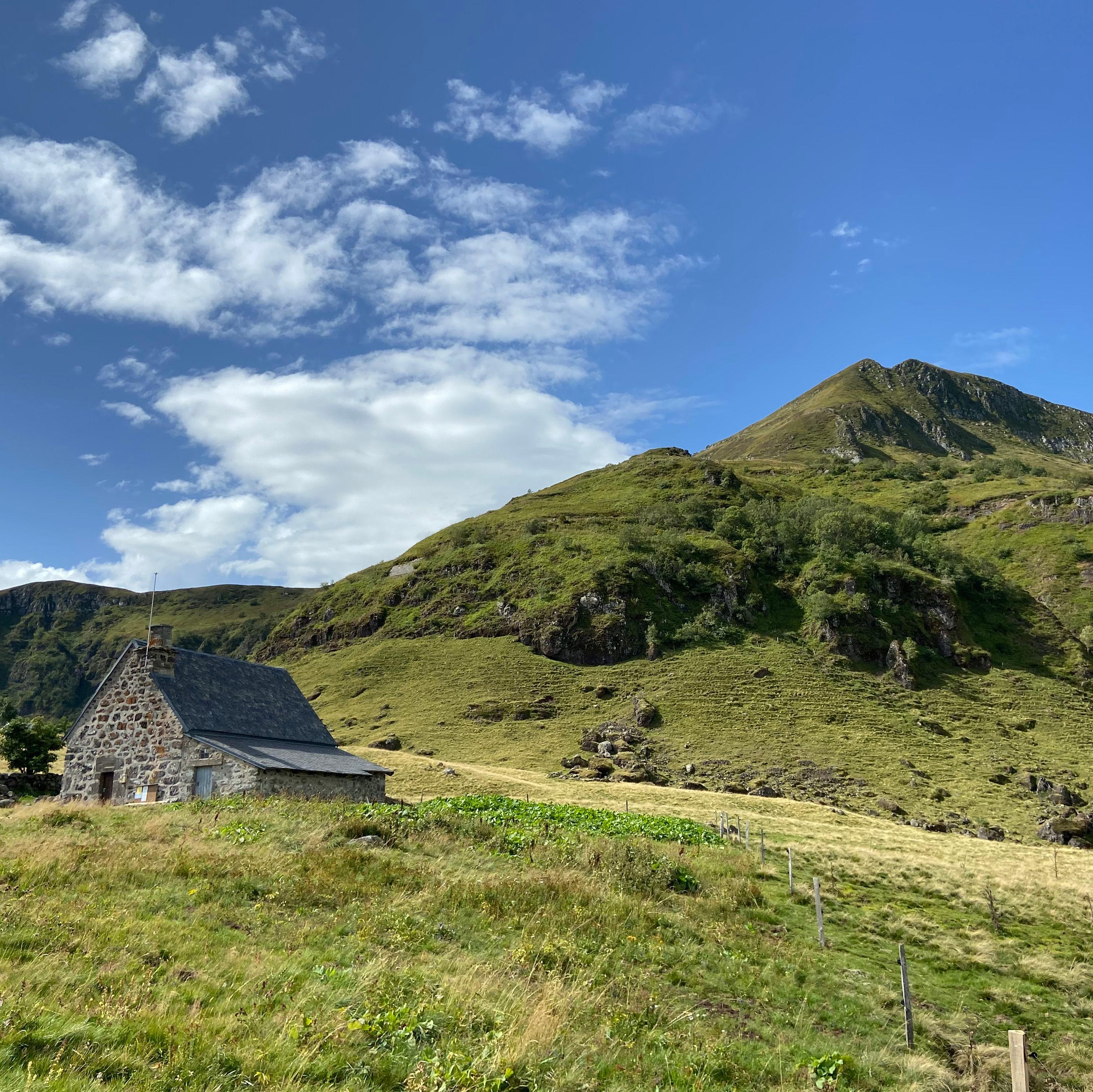
A ridge summit above Salers, reached in half a day's walk: view over the star-shaped valleys, the Maronne and the Aspre in the foreground, and almost no one to compete with you for it.
A ridge summit above the Maronne and Aspre valleys, reached on foot from the Col de Néronne. Almost no one up there.
A natural viewpoint over the Maronne and Aspre valleys, in the Cantal mountains, in the commune of Saint-Paul-de-Salers. A sweeping view down onto the star-shaped valleys, basalt cliffs, summer pastures (estives). Access by the ridge path from the Col de Néronne (D680): allow about 11 km and 4 hours there and back, a proper hike. Open access, free, little visited. Can be combined with Salers, one of the Plus Beaux Villages de France (Most Beautiful Villages of France), 15 minutes away. Come at sunset for the light on the summer pastures, with a head torch for the way back down.
Why we love it
- The Maronne and Aspre valleys opening out like a star below the summit
- The basalt cliffs of the Cantal mountains
- The summer pastures all around the ridge
- The evening light on the summer pastures
Top tip
Sunset = wonderful light on the summer pastures, but pack a head torch for the way down. Can be combined with Salers (15 min) and Puy Violent (neighbouring massif).
Before you go
- It's a proper hike: the ridge path starts from the Col de Néronne (D680), about 11 km and 4 hours there and back.
- Access is open and free, and you'll hardly meet anyone.
- Sunset gives the best light on the summer pastures, but take a head torch for the way back down.
- Salers is 15 minutes away, so you can end the day in the village.
Weather for the next 3 days
Today
7°/1°
16 mm · 34 km/h
Tomorrow
11°/1°
dry · 12 km/h
Tue 27
13°/7°
0 mm · 20 km/h
Source: Open-Meteo (CC BY 4.0). General lowland forecasts, to be cross-checked with specialist mountain forecasts at altitude.
Practical info
- Address
- Roc des Ombres, 15140 Saint-Paul-de-Salers, France
15140 Saint-Paul-de-Salers
What visitors say
Google rating
Average of 4 reviews on Google Maps.
Community rating
No reader reviews yet: yours gets things started.
Your logbook
Around Roc des Ombres
Enough to build your day around this address.
A place to see, a night to spend?
Hotels, gîtes and B&Bs within 20 km of Saint-Paul-de-Salers. Availability and online booking.
Worth seeing nearby

Cascade du Biaguin
4.7Le Falgoux · 1.2 km away

Cascade de Pissa del Coin
4.4Le Fau · 2.9 km away

Puy Mary
4.8Le Claux · 4.0 km away

Cascade du Luc
3.9Mandailles-Saint-Julien · 6.4 km away
Hikes nearby
Waymarked routes within 15 km, GPX track included.
 On foot
 On foot
Hikes around Roc des Ombres
On footOn foot On foot
Cases de Cotteughes
Start: Parking aménagé des Cases de Cotteughes, Saint-Vincent-de-Salers, 15380
- 6.5 km
- +211 m
- 2 h 15 min
You might also like
More viewpoints in Cantal and nearby.

Salers
Salers · Cantal

Le Sommet
4.2Le Mont-Dore · Puy-de-Dôme
707 reviews
Puy Mary
4.8Le Claux · Cantal
1389 reviews

La Maison de la Salers
4.3Saint-Bonnet-de-Salers · Cantal
564 reviews

La Banne d'Ordanche
4.8Murat-le-Quaire · Puy-de-Dôme
345 reviews

La Cave de Salers
4.3Salers · Cantal
184 reviews