
Our take
A wild high plateau in the heart of Auvergne. More than 500 km², almost empty, Salers cows, burons: a rare end-of-the-world feel.
High plateau between the Puy-de-Dôme and the Cantal: steppes, burons (stone huts on the summer pastures) and Salers cows. Auvergne's Mongolia.
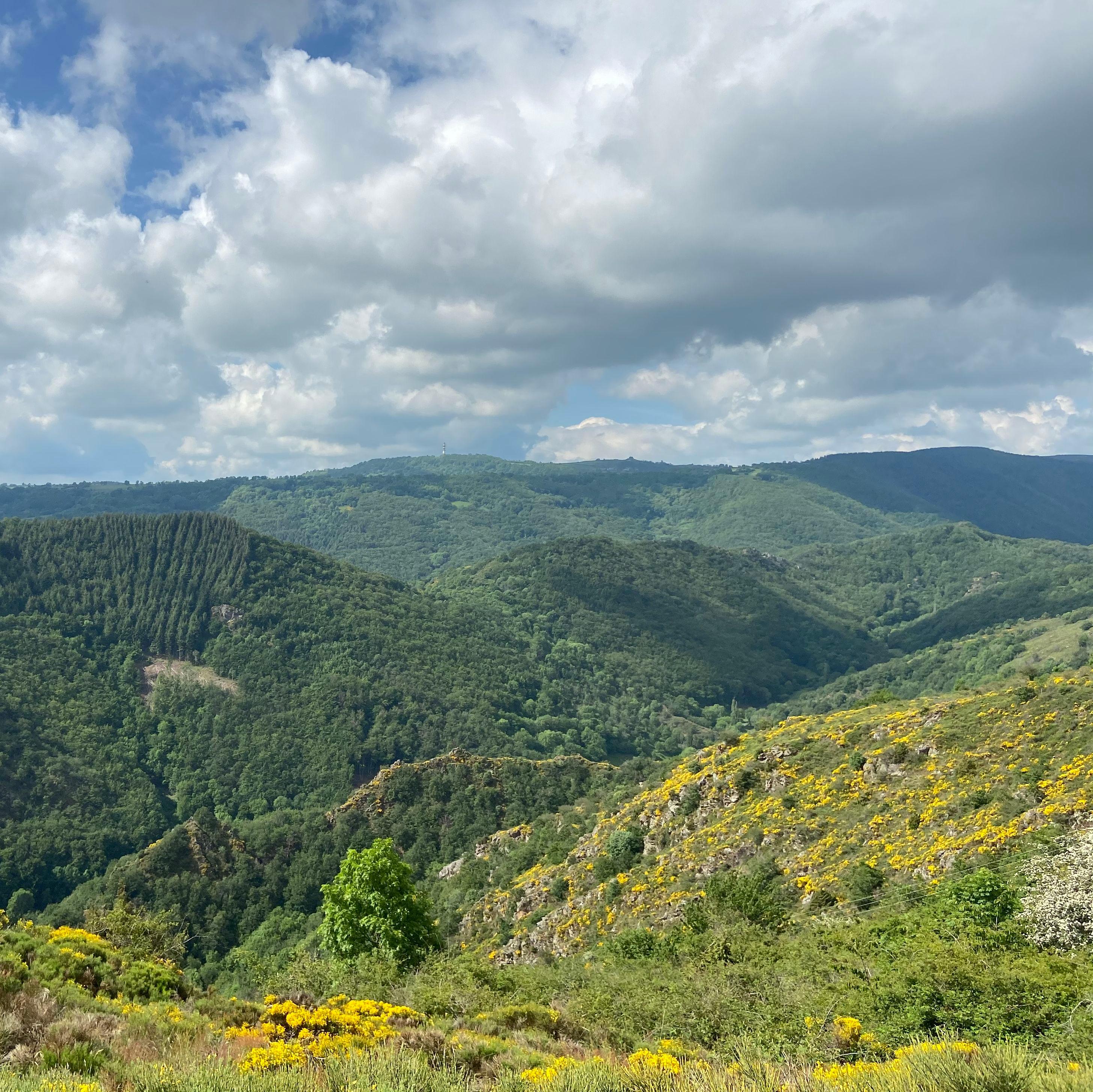
The Cézallier is a high plateau straddling the Puy-de-Dôme and the Cantal: more than 500 km² lying above 1,000 m (1,551 m at the Signal du Luguet), where almost nobody lives year-round. You drive, and the landscape empties out: grassy steppes, peat bogs, stone burons (the old summer-pasture huts) in the middle of the grazing land. The area is nicknamed the “Mongolia of Auvergne”, and once you are there you quickly see why.
From May to October, Salers and Aubrac cows go up to the summer pastures and take over the plateau. Several areas are listed under Natura 2000, including the Sagnes de La Godivelle and the Compains sector. Since 1 September 2026, the peat bogs and lakes of the Cézallier and the Artense also carry the Ramsar label, which recognises wetlands of global importance. For walking, there is no shortage of waymarked paths: the GR4 and the GR30 cross the plateau.
The classic gateways: Anzat-le-Luguet, Compains or La Godivelle.
Why we love it
- Lands far from the noise, where you take your time
- The lakes and peat bogs dotted across the plateaus
- The old stone burons, roofed with lauzes (stone slabs) or slates
- Salers and Aubrac cows on the summer pastures of the plateau, from May to October
- That sense of space
Top tip
Two times to go: June to July, when the cows are on the summer pastures and the meadows are in flower, and mid-September to mid-October for the red deer rut, to listen to at daybreak or nightfall from the edge of the woods (dates vary from year to year). Combine it with the Sagnes de La Godivelle (nature reserve). Prevailing wind: bring a windproof jacket.
Before you go
- Red deer rut from mid-September to mid-October: listen to it without approaching the animals on foot, without making noise and without shining your headlights on them.
- Come between May and October to cross paths with Salers and Aubrac cows on the summer pastures of the plateau.
- Waterproof shoes recommended: the plateau is dotted with lakes and peat bogs
- Compains and La Godivelle are good gateways on the Puy-de-Dôme side
Weather for the next 3 days
Today
7°/1°
6 mm · 56 km/h
Tomorrow
10°/2°
dry · 30 km/h
Tue 27
14°/8°
dry · 27 km/h
Source: Open-Meteo (CC BY 4.0). General lowland forecasts, to be cross-checked with specialist mountain forecasts at altitude.
Practical info
- Address
- Cézallier, 63420 Anzat-le-Luguet, France
63420 Anzat-le-Luguet
What visitors say
Google rating
Average of 43 reviews on Google Maps.
Community rating
No reader reviews yet: yours gets things started.
Your logbook
Around Cézallier
Enough to build your day around this address.
A place to see, a night to spend?
Hotels, gîtes and B&Bs within 20 km of Anzat-le-Luguet. Availability and online booking.
Worth seeing nearby

Cascade de Jassy
4.6Saint-Alyre-ès-Montagne · 5.2 km away

Cascade de la Terrisse
4.7Vèze · 5.8 km away

Cascade du Saillant
4.7Marcenat · 5.9 km away

Réserve naturelle des Sagnes de La Godivelle
4.7La Godivelle · 7.9 km away
Hikes nearby
Waymarked routes within 15 km, GPX track included.
 On foot
 On foot
From Brion to Anzat (stage 2 of the Tour des Vaches Rouges)
Start: Brion “Le Foirail” à Compains
- 16.5 km
- +382 m
- 5 h 15 min
Worth a read
Articles and guides that mention this place.

Guide
Les plus belles cascades d'Auvergne
L'Auvergne, terre volcanique, tombe naturellement en cascades. On a réuni ici nos préférées, quand y aller et comment les visiter en sécurité, avec un lien vers la fiche de chacune.

Guide
Randonnées d'automne en Auvergne : 8 boucles dans les couleurs
Hêtraies du Livradois, vallée glaciaire du Sancy, sucs du Velay, plateaux du Cézallier : nos 8 boucles préférées pour randonner dans les couleurs, de la balade tranquille à la grosse journée.

Guide
GR30 : le tour des lacs d'Auvergne étape par étape
Distance réelle, découpage en 9 étapes, sens de la boucle, bivouac, hébergements et meilleure saison : notre guide complet du GR30, le tour des lacs d'Auvergne.

Guide
Hébergement insolite en Auvergne · cabanes, bulles, dômes, yourtes et lodges spa
Cabanes perchées, bulles, dômes géodésiques, yourtes, tiny houses et lodges avec spa privatif : notre sélection de nuits insolites en Auvergne, classée par type.
Hikes around Cézallier
On footOn footFrom Brion to Anzat (stage 2 of the Tour des Vaches Rouges)
Start: Brion “Le Foirail” à Compains
- 16.5 km
- +382 m
- 5 h 15 min
 On foot
You might also like
More nature reserves in Puy-de-Dôme and nearby.

Cascade du Trou de la Conche
4.1Vic-sur-Cère · Cantal
37 reviews

Gorges de Ceyrat
4.5Ceyrat · Puy-de-Dôme
590 reviews

Lac de Malaguet
4.1Monlet · Haute-Loire
11 reviews

Réserve naturelle régionale des tourbières du Jolan et de la Gazelle
4.8Ségur-les-Villas · Cantal
22 reviews

Tourbière de Gayme
4.6Picherande · Puy-de-Dôme
18 reviews

Forêt de Tronçais
4.6Meaulne-Vitray · Allier
251 reviews