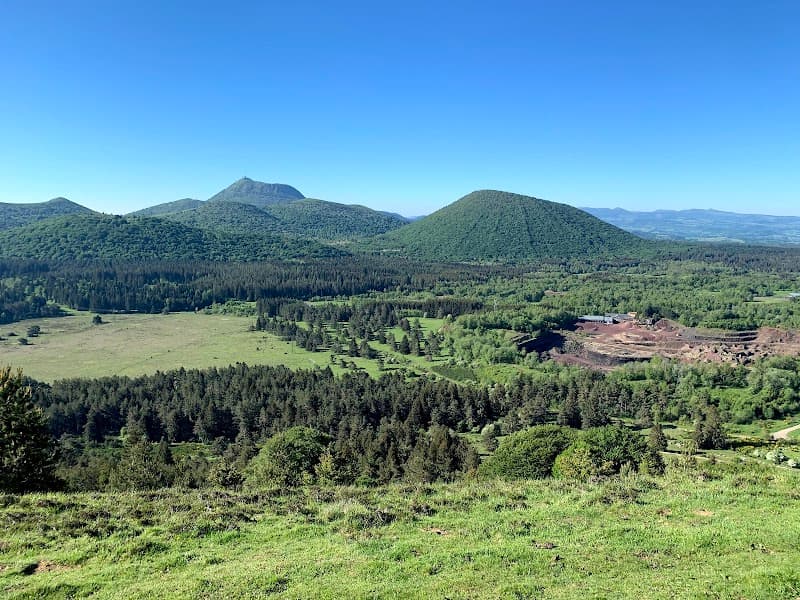
Which volcano should you climb in the Chaîne des Puys? For a first outing or with children, start with Puy de Combegrasse: 80 m of climbing and the whole chain laid out in front of you. For the perfect crater, it's Puy de Pariou. For a sharp climb, Puy de Dôme by the Chemin des Muletiers: 350 to 365 m of climbing in 1.9 km. And for a proper day out, the Puy de Jumes and Puy de la Coquille loop. Here we rank every climb, from easiest to steepest, with distance, height gain, time, parking and a tip. To place the other massifs, see our guide to the volcanoes of Auvergne.
The Chaîne des Puys in a nutshell
The Chaîne des Puys is 80 volcanoes lined up over 32 km in length and 4 km in width, above Clermont-Ferrand. Together with the Limagne Fault, it has been a UNESCO World Heritage Site since 2 July 2018. Its volcanoes were born 95,000 to 8,400 years ago: young enough for their shapes to stay sharp.
Worth knowing before you set off: most of the waymarked paths cross private land, and the thin volcanic soil is damaged very quickly as soon as people tread off the paths.
Puy de Combegrasse: the warm-up
If you only climb one with little legs in tow, this is the one. The summit loop is 3.2 km with 80 m of climbing, allow 1 hour 30. Park in the car park beside the D983, at Aydat, 2 km from Randanne.
Cleared of trees from 2012, Puy de Combegrasse used to look like a simple wooded hill. Its summit, at 1,120 m, opens onto the Chaîne des Puys on one side and the Massif du Sancy on the other. Two orientation tables help you put a name to each cone.
Our tip: the summit is very exposed to the wind, take an extra layer. And leave the dog at home: Puy de Combegrasse, a summer pasture, doesn't accept dogs, even on a lead. To go further, the Puy de Combegrasse and narse d'Espinasse loop runs on to a peat bog: 9.8 km, 214 m of climbing, 3 hours. It goes over the summit of Puy de Combegrasse: no dogs there either.
Puy de Côme: you walk around it
A small exception to the title: you don't climb Puy de Côme. Its summit is closed to the public, to protect a badly damaged volcano. The walk around it, though, involves hardly any climbing: 6 km, 138 m of height gain, 1 hour 45, blue waymarks. The car park is on the D559, 1.4 km from Vulcania.
Puy de Côme tops out at 1,252 m. It's the second-largest volcano in the chain, with two nested craters. The path winds through the beech forest, and the high point gives you the view of its double cone.
Our tip: dogs must be on a lead, because of the livestock. And stop at the charcoal kilns: these big rusty cauldrons are charcoal burners' pots, the trace of an old practice.
Puy Chopine and Puy des Gouttes: two interlocking volcanoes
A 6 km loop, 176 m of climbing, 2 hours, blue waymarks. Start from the large car park on the D559, towards Chanat, 200 m after the Vulcania roundabout.
The interest here is the geology. Puy des Gouttes is a cone around 30,000 years old, cut through by Puy Chopine, which is around 10,000 years old. At the summit of Les Gouttes, at 1,134 m, the rocky needle of Chopine (1,181 m) towers over the crater. You look at it, you don't climb it: Puy Chopine can't be hiked. The view runs to Puy de Dôme, the Sancy, the Artense and the Combrailles, with the Lemptégy quarry down below.
Our tip: you cross pastures, so close the gates behind you and cross the fences by the stiles. To see a volcano from the inside afterwards, the Volcan de Lemptégy, a former pozzolana quarry, is right next door.
Puy des Goules: the Pariou's neighbour
Same car park as Puy de Pariou, covered just below, for a shorter outing: 4.5 km there and back, 180 m of climbing, 1 hour 30, blue waymarks. Start from the Goules car park, on the D941 at Orcines, along a wide, gently sloping forest path. At the col, after 1.5 km, turn right: the slope steepens markedly, in switchbacks, up to the rim of the crater.
Puy des Goules tops out at 1,146 m. Its regular crater is 200 m across and 40 m deep, wooded on the west side, sheltered from the wind, and bare on the east. From the summit, you can see the Grand Sarcoui, Puy de Dôme, the Pariou and Puy de Côme.
Our tip: the site is only open to individual walkers. To make it longer, a detour leads to the Sarcoui cave: the outing then comes to 5.5 km and 311 m of climbing.
Puy de Pariou: the perfect crater
This is the poster volcano: it was the backdrop for the Volvic water advert. It's nearly 10,000 years old, which explains how sharp its shape is.
Park at the Goules car park, along the D941, after La Fontaine du Berger. A waymarked route climbs to the summit by the north face and comes back down by the steps on the south side: 6.5 km and around 250 m of climbing. The wooden steps are there to limit erosion.
At the top, the crater of Puy de Pariou opens up beneath your feet. Its floor is out of bounds, to protect a volcano that is sensitive to erosion. A prefectural order of 7 July 2023 makes it a protected natural area: you stay on the waymarked path, with no bivouacking, no fires, no picking, no drones or bikes, and your dog on a lead. The fine can reach €750.
Our tip: go up for sunrise, when the light brings out the relief. Groups, on the other hand, are not allowed on the Pariou paths.
Puy de Jumes and Puy de la Coquille: the big day out
The Puy de Jumes, Puy de la Coquille and Puy des Gouttes loop is 14.6 km with 487 m of climbing, allow 4 hours. It's graded difficult, and it's the longest in this selection.
Start from a car park on the D576: from the D943, between Saint-Ours-les-Roches and Volvic, take the D576 towards Beauregard for 900 m. On the programme: Puy de Jumes, Puy de la Coquille and Puy de Leyronne, then the rim of Puy des Gouttes, with views along the line of the chain and over the Sancy.
Our tip: water and enough food for the day. On the way back, the village of Beauregard lines up its cross, its wash-house, its fountain and its bread oven.
Puy de Dôme: a sharp climb, or a ride up by train
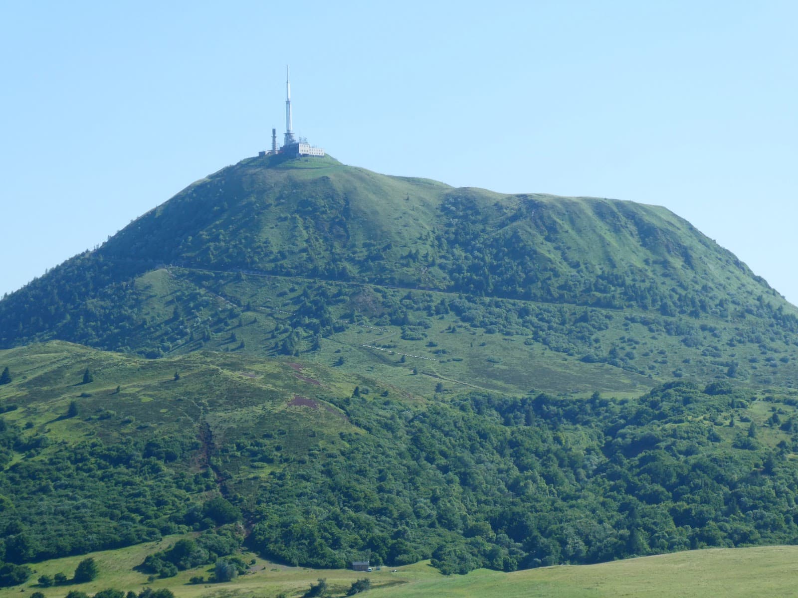
Puy de Dôme, the highest point of the chain at 1,465 m, can be reached in three ways. The most direct: the Chemin des Muletiers from the Col de Ceyssat, 1.9 km and 350 to 365 m of climbing in 15 tight switchbacks, allow 45 minutes to 1 hour. Short, but it's the steepest climb in this selection. The car park at the col has few spaces, and parking along the D68 is not allowed.
The most gradual: the Chemin des Chèvres, from the Maison de site (the visitor centre), over 5 to 6 km and 1 hour 15 to 2 hours of walking. The most restful: the Panoramique des Dômes, a rack railway that climbs in 15 minutes. In 2026, an adult return costs €17.20 from 1 October to 31 December and €18.60 from 1 April to 30 September; a single, €14.40 or €15.50 depending on the period.
Our tip: walk up, ride down by train on a single ticket, your knees will thank you. The train drops you at the Maison de site: if you took the Muletiers, a 2 km link path takes you back to the Col de Ceyssat. Careful: in November and December 2026, the train doesn't run every day: not on Mondays or Tuesdays outside the Christmas holidays, not from 16 to 20 November (maintenance), and not on 25 December. On those days, you come down on foot. Without aiming for the summit, the Puy de Dôme loop is 9.5 km and 265 m of climbing in 3 hours. All the details are in our guide to climbing Puy de Dôme, and the full day in Puy de Dôme in one day.
And Puy de la Vache?
Puy de la Vache and its neighbour, Puy de Lassolas, are undergoing works. Since 13 May 2026, a municipal order from Saint-Genès-Champanelle has banned climbing them. The site's car park has been closed since 20 April 2026. The works are restoring the paths: steps suited to the slopes, viewpoints reopened, a new reception area. Successive closures are announced until 2028, depending on the phases of the works.
A pity: Puy de la Vache (1,167 m) is a breached crater, opened into a horseshoe by its lava flow, the cheire d'Aydat, which it shares with Puy de Lassolas.
What's still possible: the long-distance footpath at the foot of the volcanoes, and the quarry at the foot of Puy de la Vache. To see the two volcanoes all the same, climb Puy de Vichatel, right next door: a 3.5 km loop, 134 to 187 m of climbing, 1 hour 15, blue waymarks, starting from the Col de la Ventouse car park. The climb opens up the view of Puy de la Vache and Puy de Lassolas, and the summit the view of the Sancy and Lac d'Aydat.
The recap
| Climb | Distance | Height gain | Time | Start |
|---|---|---|---|---|
| Puy de Combegrasse | 3.2 km | 80 m | 1 hr 30 | D983, Aydat |
| Puy de Côme loop | 6 km | 138 m | 1 hr 45 | D559, 1.4 km from Vulcania |
| Puy Chopine and Puy des Gouttes | 6 km | 176 m | 2 hrs | D559, towards Chanat |
| Puy des Goules | 4.5 km (there and back) | 180 m | 1 hr 30 | Goules car park |
| Puy de Pariou | 6.5 km | around 250 m | Goules car park | |
| Puy de Jumes and Puy de la Coquille | 14.6 km | 487 m | 4 hrs | D576, towards Beauregard |
| Puy de Dôme via the Muletiers | 1.9 km of climbing | 350 to 365 m | 45 min to 1 hr | Col de Ceyssat |
| Puy de Vichatel | 3.5 km | 134 to 187 m | 1 hr 15 | Col de la Ventouse |
Before you go: season, weather, footwear, respect for the sites
Season and weather. Most of these paths are open all year, weather permitting. In fog, some routes are not recommended, and in winter, some are no longer passable, or even prohibited. Think about the hunting season too, and adapt your route.
Bag and footwear. The summits catch the wind: even for an hour's walk, take water, a hat, warm clothes and waterproofs. And shoes with grip, because the slopes get slippery after rain.
Respect for the sites. A team shared by the Département and the Parc naturel régional des Volcans d'Auvergne has managed the Chaîne des Puys since 2020. Its rules fit in a few lines:
- stay on the waymarked paths, no shortcuts across the slopes;
- keep your dog on a lead, go around the herds and close the fences behind you;
- don't approach the patous, the dogs that guard the flocks;
- don't pick the flowers, many are protected;
- take your rubbish home with you, and no fires.
Getting there without a car. The Navette des Volcans shuttle links Clermont-Ferrand station to the Goules car park, Vulcania and the Volcan de Lemptégy, but only during the tourist periods: in 2026, the spring school holidays, some weekends in May, the summer and the Toussaint holidays (the autumn school holidays), up to 1 November. The rest of the year, it doesn't run. For Puy de Dôme, bus line P36 links Chamalières (Europe stop, easy to reach from Clermont-Ferrand station) to the Maison de site, at the foot of the volcano; its days and times of operation change with the time of year. And to string the volcanoes together on a multi-day walk, follow our guide to the GR441, the Chaîne des Puys loop.
Frequently asked questions
The FAQ
Which is the easiest volcano to climb in the Chaîne des Puys?
In this selection, it's Puy de Combegrasse, at Aydat: a 3.2 km loop with 80 m of climbing, allow 1 hour 30. The summit, at 1,120 m, has two orientation tables and opens onto the chain and the Sancy.
Can you climb Puy de la Vache during the works?
No. Since 13 May 2026, a municipal order has banned climbing Puy de la Vache and Puy de Lassolas while the paths are being restored, and the car park is closed. Successive closures are announced until 2028, depending on the phases of the works. The long-distance footpath at the foot of the volcanoes and the quarry remain accessible.
Can you go down into the crater of Puy de Pariou?
No, access to the crater floor is prohibited to protect the volcano from erosion. You climb to the summit by the waymarked paths and the steps, without ever leaving them. Since the prefectural order of 7 July 2023, leaving the waymarked path, bivouacking or picking plants can land you a fine of up to €750.
Do you have to pay to climb these volcanoes?
Not for these paths: the Pariou, the Goules, Puy de Combegrasse and the Puy de Côme loop are open access, all year. At Puy de Dôme, you pay for the rack railway. In 2026, an adult return costs €17.20 from 1 October to 31 December, and €18.60 from April to September.
Can you hike with your dog?
On most of these paths, yes, on a lead, because of the livestock. At the Pariou, a lead is compulsory across the whole site, as on the paths of Côme, Les Gouttes and Vichatel. One exception to note: at Puy de Combegrasse, a summer pasture, dogs are not admitted, even on a lead; the narse d'Espinasse loop, which goes over this summit, is therefore also done without a dog.