The GR30 loops round the Auvergne lakes over about 200 km, to be walked in 8 to 10 days, classically starting from La Bourboule. Waymarked white and red, it links the Massif du Sancy, the couzes country (couze is the local name for a river) and the plateaux of the Cézallier, passing the lakes of Guéry, Servières, Aydat, Chambon, Pavin, Montcineyre and Chauvet, and the lakes of La Godivelle. Here is the stage-by-stage breakdown, the direction we recommend, the bivouac rules and the period we prefer (autumn, by a long way).
The GR30 in brief
The tour of the Auvergne lakes is a route approved in the early 1970s, entirely in the Puy-de-Dôme, in the heart of the Parc naturel régional des Volcans d'Auvergne. A loop: you come back to your starting point, with no shuttle logistics.
The figures to remember:
- Distance: about 200 km
- Typical duration: 8 to 10 days, with a reference breakdown into 9 stages
- Total ascent: about 5,500 m of climbing
- High point: above 1,800 m on the Sancy ridges
- Waymarking: white and red, like any GR
- Usual start: La Bourboule (or Le Mont-Dore, right next door)
The level remains accessible to any walker used to days of 5 to 7 hours. Nothing technical, but daily ascent and plateaux where fog can blur your bearings: a GPS track in your pocket is never a luxury. To place the route on the map, take a look at our GR30 page.
And if you'd like to brush up on your lakes before lacing your boots, we have a complete guide to the volcanic lakes of Auvergne that sets the scene.
The stages one by one
The breakdown below follows the classic direction of the topoguide, starting from La Bourboule. Stage towns can shift depending on your accommodation and the variants you choose.
Stage 1: from La Bourboule to Orcival
The warm-up is serious, with a real climb from the first day. You climb above La Bourboule, pass the Banne d'Ordanche, then tip over towards Lac de Guéry, the highest in Auvergne at about 1,250 m. Facing you, the Roches Tuilière and Sanadoire frame the valley like two pillars.
The path then runs to Lac de Servières, a crater set in the woods, before dropping to Orcival and its Romanesque basilica. A first day that sets the tone: you quickly understand why this GR has its devotees.
Stage 2: from Orcival to Aydat
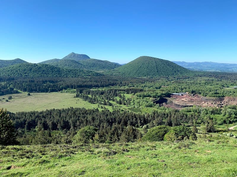
A more rolling day, between woods and pastures, with the Chaîne des Puys as a backdrop on the north side. You first pass Lac de la Cassière, discreet and ringed with greenery, before arriving at Lac d'Aydat, the largest natural lake in Auvergne.
Aydat is a real comfort stop: shops, accommodation, waterside terraces. The walk round the lake in the evening, when the paddleboards are put away, is worth the detour.
Stage 3: from Aydat to Saint-Nectaire
The most secret stage of the loop. The GR plunges into the Gorges de la Monne, a green corridor where you will hardly meet anyone, then climbs back up to the plateaux of the couzes country.
Arriving in Saint-Nectaire has to be earned, and it rewards you: the Romanesque church on its hillock, the cheese-maturing cellars, and a slice of farmhouse cheese that tastes different after a day's walking.
Stage 4: from Saint-Nectaire to Besse
You pass through Murol, dominated by its medieval castle, then skirt Lac Chambon and its indented shores. It is one of the busiest sections of the GR in summer; in September, you will almost have it to yourself.
The final climb leads to Besse-et-Saint-Anastaise, a medieval town in lava stone, perfect for a long break. If you need to split the loop into two trips, this is where we would do it.
Stage 5: from Besse to Brion
The day of the lakes with character. First Lac Pavin, an almost perfectly round crater, the deepest in Auvergne at 92 m, and the youngest crater lake in mainland France (6,900 years). We advise arriving early: the morning light on the dark water is a moment apart.
Lac de Bourdouze, peaceful and surrounded by peat bogs, is worth the side trip if your legs are up to it. Then the path reaches Lac de Montcineyre, crescent-shaped at the foot of its wooded cone, before Compains and the hamlet of Brion.
Stage 6: from Brion to Égliseneuve-d'Entraigues
Welcome to the Cézallier, the part of the GR30 that feels most like another world. Plateaux of short grass as far as the eye can see, burons (the old stone huts of the summer pastures), cows, and a great silence.
The path passes through La Godivelle, a tiny village between its two lakes, where the Sagnes de La Godivelle nature reserve protects rare peat bogs. Stay on the paths, and put the drone away: the site is strictly protected. The stage ends at Égliseneuve-d'Entraigues.
Stage 7: from Égliseneuve-d'Entraigues to Saint-Genès-Champespe
You leave the Cézallier for the Artense, a granite plateau scattered with peat bogs and small lakes. It is the most out-of-the-way portion of the loop, the one where the GR30 feels like a secret well kept by the locals.
No spectacular site here, and that's precisely the charm: hours of steady walking, isolated farms, the feeling of being very far from everything.
Stage 8: from Saint-Genès-Champespe to Chareire
The route heads for Picherande and its hamlet of Chareire, at the foot of the southern slope of the Sancy. In the commune, Lac Chauvet occupies a maar crater edged with beeches.
It's the eve of the grand finale: make the most of a proper night's rest, as the last stage climbs onto the Sancy ridges, the high point of the loop.
Stage 9: from Chareire to La Bourboule
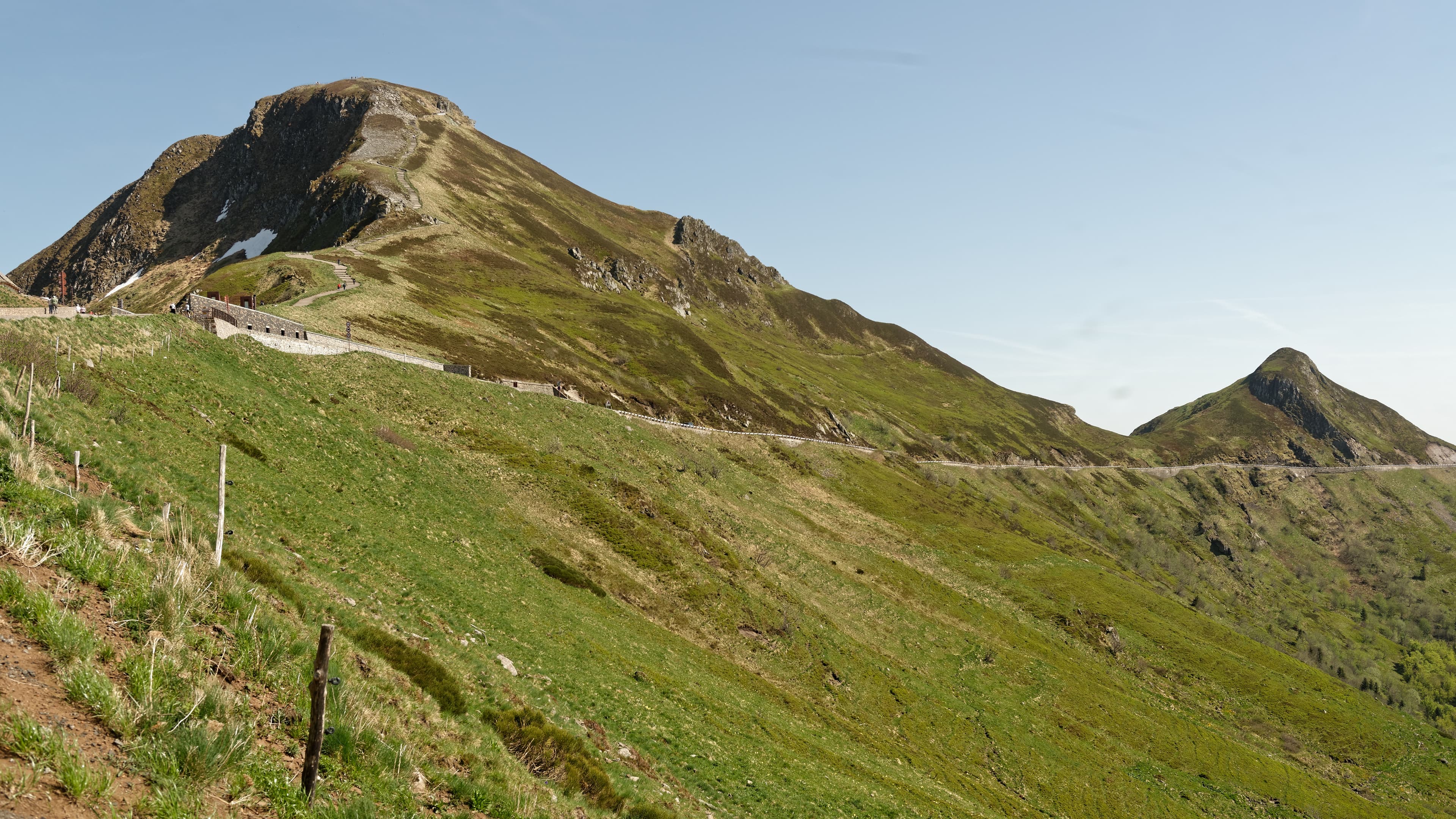
The grand finale. The path crosses the landscapes of the Chastreix-Sancy nature reserve, reaches the ridges of the massif and brushes past Puy de Sancy, the roof of the Massif Central. In clear weather, you take in the whole loop at a glance: the Cézallier to the south, the lakes to the north, the Chaîne des Puys on the horizon.
If you want to add the summit itself, our guide to climbing Puy de Sancy details the options. Then it's the long descent to La Bourboule, with heavy legs and a full head.
The stage summary table
| Stage | Route | Worth remembering |
|---|---|---|
| 1 | La Bourboule → Orcival | Lakes Guéry and Servières, Roches Tuilière and Sanadoire |
| 2 | Orcival → Aydat | Lakes La Cassière and Aydat |
| 3 | Aydat → Saint-Nectaire | Gorges de la Monne, Romanesque church |
| 4 | Saint-Nectaire → Besse | Murol, Lac Chambon |
| 5 | Besse → Brion | Lakes Pavin, Bourdouze and Montcineyre |
| 6 | Brion → Égliseneuve-d'Entraigues | Cézallier, La Godivelle and its two lakes |
| 7 | Égliseneuve → Saint-Genès-Champespe | Artense plateau, peat bogs |
| 8 | Saint-Genès-Champespe → Chareire | Lac Chauvet, foot of the Sancy |
| 9 | Chareire → La Bourboule | Sancy ridges, high point of the loop |
For detailed maps and precise descriptions, take the topoguide (walking guide) “Volcans et lacs d'Auvergne” (9th edition, May 2026).
Which way round, and where to start?
The GR30 is a loop: you can start wherever you like and go round in either direction. The usual start remains La Bourboule, the best-served town on the route, with Le Mont-Dore as an immediate alternative.
We recommend the classic direction, the one in the breakdown above. It builds a real crescendo: the star lakes at the start, the great emptiness of the Cézallier in the middle, and the Sancy ridges as the climax on the last day. Going the other way, you burn through the best on the very first stage.
Another option we like: starting at Besse if you are coming by car from the east, which puts the Cézallier at the start of the walk and the string of lakes as the final reward. If you have already walked the Chemin de Stevenson, you will find the same spirit of long-distance walking here, with one clear advantage: no return shuttle to organise.
When to set off on the GR30?
The loop can be walked from May-June to October, outside spells of late or early snow on the ridges. June has its supporters, flowering meadows foremost. July-August concentrates the crowds around Pavin, Chambon and Aydat.
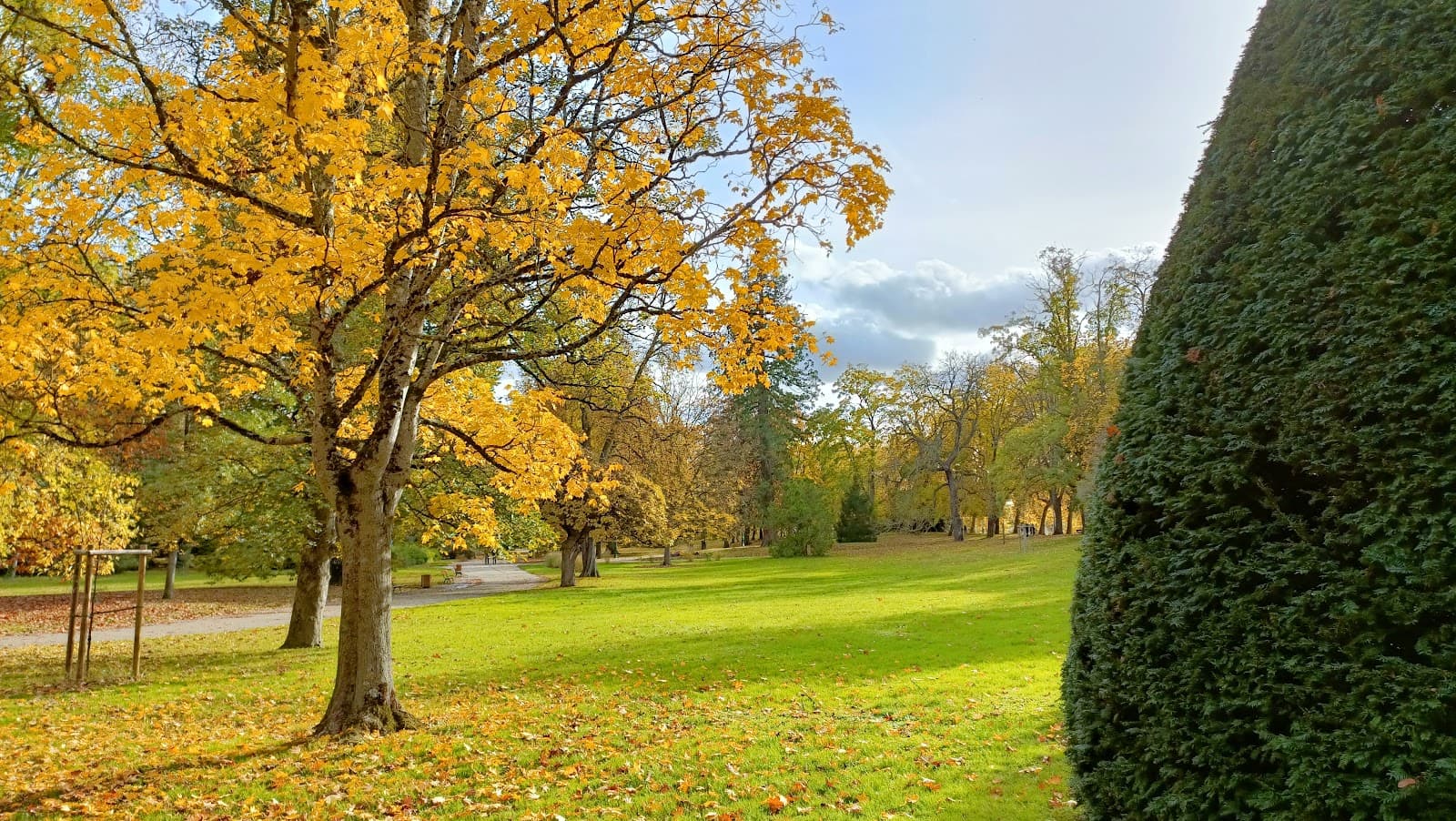
Our preferred slot, without hesitation: September and October. Accommodation frees up, the summer pastures empty, the low light skims the plateaux of the Cézallier and the Sancy forests turn russet. You walk whole half-days without meeting anyone, something unthinkable on 15 August.
Two caveats for autumn: the days get shorter (set off early) and some accommodation closes after the season: book your nights before you set off. Autumn fog on the Cézallier is part of the game: wonderful when it breaks up, demanding for navigation.
And on the lakes, a point that matters in the late season: here we are talking about breaks on the shores and walks round the lakes, not swimming. Swimming is prohibited on several lakes on the route, notably at Pavin, Guéry, Servières and Chauvet (a private lake). Respect the signs on site, they have the final word.
Bivouac and accommodation: where to sleep on the GR30?
Under a roof: the GR30 passes through well-equipped towns (La Bourboule, Orcival, Aydat, Saint-Nectaire, Murol, Besse, Égliseneuve-d'Entraigues, Picherande) with gîtes d'étape (walkers' lodgings), guesthouses, hotels and campsites. The offer thins out markedly in the Cézallier and the Artense: between Besse and Picherande, book before you leave, as there is sometimes only one address per village.
In a tent: along the GR30, bivouacking is tolerated with the landowner's prior agreement. Tent pitched at sunset and packed away at sunrise, away from volcano summits, with no fire and leaving no rubbish at all.
Bivouacking is, however, prohibited in the national nature reserves of Chastreix-Sancy, the Vallée de Chaudefour and the Sagnes de La Godivelle, at the Lac de Guéry site (an Espace naturel sensible, a sensitive natural area) and in the commune of Chambon-sur-Lac, by municipal order. Two equipped bivouac areas are on the route, at Picherande and Le Mont-Dore. The one at Chastreix is 3 km away via the Col de Courre, the one at Super-Besse 2.5 km away via the Col de Couhay.
Our advice: mix and match. Bivouac on the plateaux when the weather allows, a gîte on rainy evenings or to recharge (batteries and morale). A warm sleeping bag is essential even in summer: nights above 1,000 m are sharp.
How to get to the start of the GR30?
The access point is Clermont-Ferrand, linked by train to Paris and Lyon. After that, there is no more train to La Bourboule or Le Mont-Dore: the regional coach P46 takes over from bus bay no. 6, in front of Clermont-Ferrand SNCF station, to the former railway stations of La Bourboule and Le Mont-Dore (a 1 hour 30 journey to Le Mont-Dore). On the timetable running from 1 September 2026 to 31 August 2027, it runs every day, with departures from Clermont at 07:45, 10:45, 12:45, 14:10, 17:45 and 19:45. From the former stations, an unwaymarked link, described in the topoguide, leads to the start of the GR30.
By car, the loop has an advantage: you find your vehicle at the finish, with no shuttle to organise. But parking in the same place is not allowed beyond 7 days: at Le Mont-Dore, an online form is provided for parking while on a long-distance hike; at La Bourboule, the best thing is to contact the gendarmerie before you leave.
If the full trek seems too big for a first stay, nothing stops you tasting the massif by the day: our top 10 hikes in the Sancy gives you plenty to do, and several stages of the GR30 are easily walked as out-and-backs.
Frequently asked questions
The FAQ
How long is the GR30?
Allow about 200 km for the full loop, with more than 5,500 m of cumulative ascent. The distance you will actually walk depends on your accommodation and the detours you choose, such as the one to Lac de Bourdouze.
How many days of walking is the GR30?
The classic breakdown has 9 stages, i.e. 9 days of walking at a comfortable pace. Walkers in a hurry complete it in a short week with big days, the contemplative treat themselves to 10 days. Nothing stops you splitting the loop into two trips either, for example at Besse.
Where does the GR30 start?
It's a loop, so the start is free. The custom is to start from La Bourboule or Le Mont-Dore, the best-served towns on the route, reachable by regional coach (line P46) from Clermont-Ferrand station. Starting at Besse or Aydat also works very well if you arrive by car from the east.
Can you bivouac on the GR30?
Yes, with the landowner's prior agreement: tent pitched at sunset, packed away at sunrise, with no fire or rubbish. Bivouacking is prohibited in the nature reserves of Chastreix-Sancy, the Vallée de Chaudefour and the Sagnes de La Godivelle, at the Lac de Guéry site and in the commune of Chambon-sur-Lac. Two equipped areas are on the route, at Picherande and Le Mont-Dore.
What is the best time of year for the GR30?
September and October, for the autumn colours, the available accommodation and the empty paths. June is also appealing with its flowering meadows. Avoid the height of summer if you are looking for calm around Pavin and Chambon, and avoid winter: while the Sancy ski resorts are open, the route is inaccessible to hikers.
Is the GR30 difficult?
It's a medium-level GR: no technical sections, but daily ascent and sometimes long stages. The last day climbs onto the Sancy ridges, the high point of the loop. The real trap is fog on the Cézallier: take the GPS track and something to cover up with in every season.