
Our take
A low-key record: the largest natural lake of glacial origin in the Massif Central, on the list of protected sites since 1973, with an easy 5 km loop to walk round it.
The largest natural lake of glacial origin in the Massif Central, sitting on the Artense plateau. Swimming is not allowed: you come for the walk round the lake, fishing and picnics.
Can you swim in Lac de la Crégut?
No, swimming is not allowed at Lac de la Crégut. No beach and no lifeguards: here, you walk, you fish, you picnic. For a swim, the fallback is obvious: the beach at Lac de Lastioulles, very close by, with supervised swimming in July and August in 2026, a water sports base and the Pavillon Bleu (Blue Flag) label.
The glacial giant of the Artense
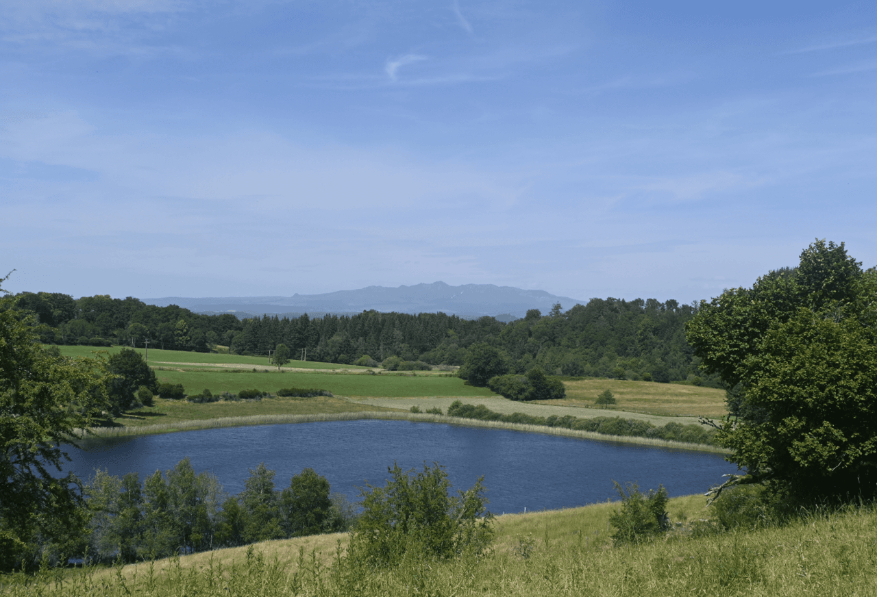
Considered the largest natural lake of glacial origin in the Massif Central, the Crégut spreads 36 hectares of dark water at an altitude of 860 metres. The Artense glacier carved out the basin about 13,500 years ago, and the site has been on the list of protected sites since 1973, in the Parc des Volcans d'Auvergne.
But the lake leads a double life: since 1969, part of the water diverted by the Haute-Tarentaine hydroelectric complex (Tarentaine, Eau Verte) has passed through its basin. A local association, created in 1992, is fighting the silting up that it attributes to this transit.
The walk round the lake follows PR 2 “Histoire d'eau”: 5 km waymarked in blue, no difficulty, allow less than two hours. Picnic tables await you along the route. Anglers hunt zander, pike, perch and carp (second category in the French fishing classification, boating limited to 6 km/h).
Our take
You don't visit the Crégut in a swimsuit, you walk it. Indented shores, dense forest, an almost Scandinavian feel. If you want a beach and pedalos, head straight to Lastioulles. If you want two hours of walking between lakes and peat bogs, this is the place, and carry on to Lac du Tact, right next door.
Why we love it
- Dark water at an altitude of 860 metres, on the Artense plateau
- A basin carved by the Artense glacier about 13,500 years ago
- An indented shoreline and dense forest, almost a Scandinavian feel
- Zander, pike, perch and carp for those who come with a rod
Top tip
Extend the walk to Lac du Tact, right next door: the path passes close by and links lakes and peat bogs, the typical landscape of the Artense.
Before you go
- From May to October for the loop and a picnic.
- Swimming is not allowed here, and there is no beach and no lifeguard: you come to walk, fish and picnic.
- For a swim, the fallback is Lac de Lastioulles, right next door.
- Picnic tables are set up along the route round the lake.
Weather for the next 3 days
Today
11°/3°
7 mm · 27 km/h
Tomorrow
13°/2°
dry · 8 km/h
Tue 27
17°/9°
1 mm · 18 km/h
Source: Open-Meteo (CC BY 4.0). General lowland forecasts, to be cross-checked with specialist mountain forecasts at altitude.
Practical info
- Address
- Lac de la Crégut, 15270 Trémouille, France
15270 Trémouille
What visitors say
Google rating
Average of 30 reviews on Google Maps.
Community rating
No reader reviews yet: yours gets things started.
Your logbook
Around Lac de la Crégut
3 spots in and around Trémouille, enough to build your day.
Where to stay nearby

Hikes nearby
Waymarked routes within 15 km, GPX track included.
 On foot
 On foot
Hikes around Lac de la Crégut
On footOn foot On foot
You might also like
More lakes in Cantal and nearby.

Sagnes de La Godivelle nature reserve
4.7La Godivelle · Puy-de-Dôme
88 reviews

Lac de Saint-Front
4.3Saint-Front · Haute-Loire
245 reviews

Lac de Bourdouze
4.5Besse-et-Saint-Anastaise · Puy-de-Dôme
139 reviews

Lac de Guéry
4.7Le Mont-Dore · Puy-de-Dôme
813 reviews

Lac de Menet
4.6Menet · Cantal
59 reviews

Lac d'Aydat
4.5Aydat · Puy-de-Dôme
92 reviews