
From the Enfer to the rouets
Start: Orangerie
This route is a genuine journey back through the history of cutlery-making and industry in Thiers.
- Distance
- 11.4 km
- Elevation gain
- +513 m
- Elevation loss
- -513 m
- Duration
- 4 h 15 min
Route on the map
Base map © OpenTopoMap (CC-BY-SA): route licensed under ODbL via Données : Parc Naturel Régional Livradois-Forez · rando.parc-livradois-forez.org — sous licence ODbL.
The feel of the route
It goes up the "vallée des usines" (valley of the factories), a moving testimony to the "golden age" of the cutlery trade. Then, through a gorge with oaks and rocky ground, it reaches the "vallée des rouets", a major site in the cutlery history of Thiers.
The route in detail
Cross the road and take a small street (rue des usines) with a sign: "atelier de coutellerie - CRT / ville de Thiers" (cutlery workshop) (mill mechanisms on the left). Cross the bridge and turn right to climb a small street, go up some steps. At the top of these steps, turn right (view of the upper town, a few old factories). Follow a small path at the end of which you come to a bridge, which you take.
(1) Turn left onto the road. At the contemporary art centre, "le Creux de l'Enfer", take the footbridge over the Durolle on the left, climb the metal steps and carry straight on (on the right, the usine du May, an industrial architecture interpretation centre and economic showcase). Go back up the street before leaving it on the right. Cross a footbridge and continue to the right again to go through a green chicane (zigzag barrier) and into the gardens of the former hospital (upper town on the left, a string of old factories on the right). Leave the gardens of the former hospital through another green chicane. At the top of a short climb, turn right.
(2) Cross the Pont de Seychalles to get across the road. Climb the rue des Papeteries opposite the bridge and carry straight on between the houses along the little rue Saint-Roch (leave the rue des Papeteries on your right). Cross the rue Saint-Roch to reach the chapel. From the Saint-Roch chapel, climb alongside the houses and take the steps to reach Dégoulat (viewpoint: Thiers in the foreground, Chaîne des Puys and Massif du Sancy in the background).
(3) In the hamlet, turn left and follow the path that winds along the mountainside. Stay on that same path. Pass through the middle of a jumble of rocks (viewpoint: Thiers, Monts Dore, Monts Dôme and Monts du Cantal in clear weather) then under the penstock. 250 m after it, go down the path on the left. Continue opposite to the T-junction. Then go down to the right and cross the stone bridge. At the next junction, go down to the right. Carry on opposite, cross the footbridge and continue to the rouet (cutlery grinding workshop) (do not enter the rouet) then carry straight on.
(4) Cross the Durolle by the stone bridge and climb opposite. Go up the steps to follow the path on the right that overlooks the Durolle. Pass rouet 14 (chez Beaujeu) then rouets 11 and 12 (chez Djina). Stay on this laid-out path as far as the reception building.
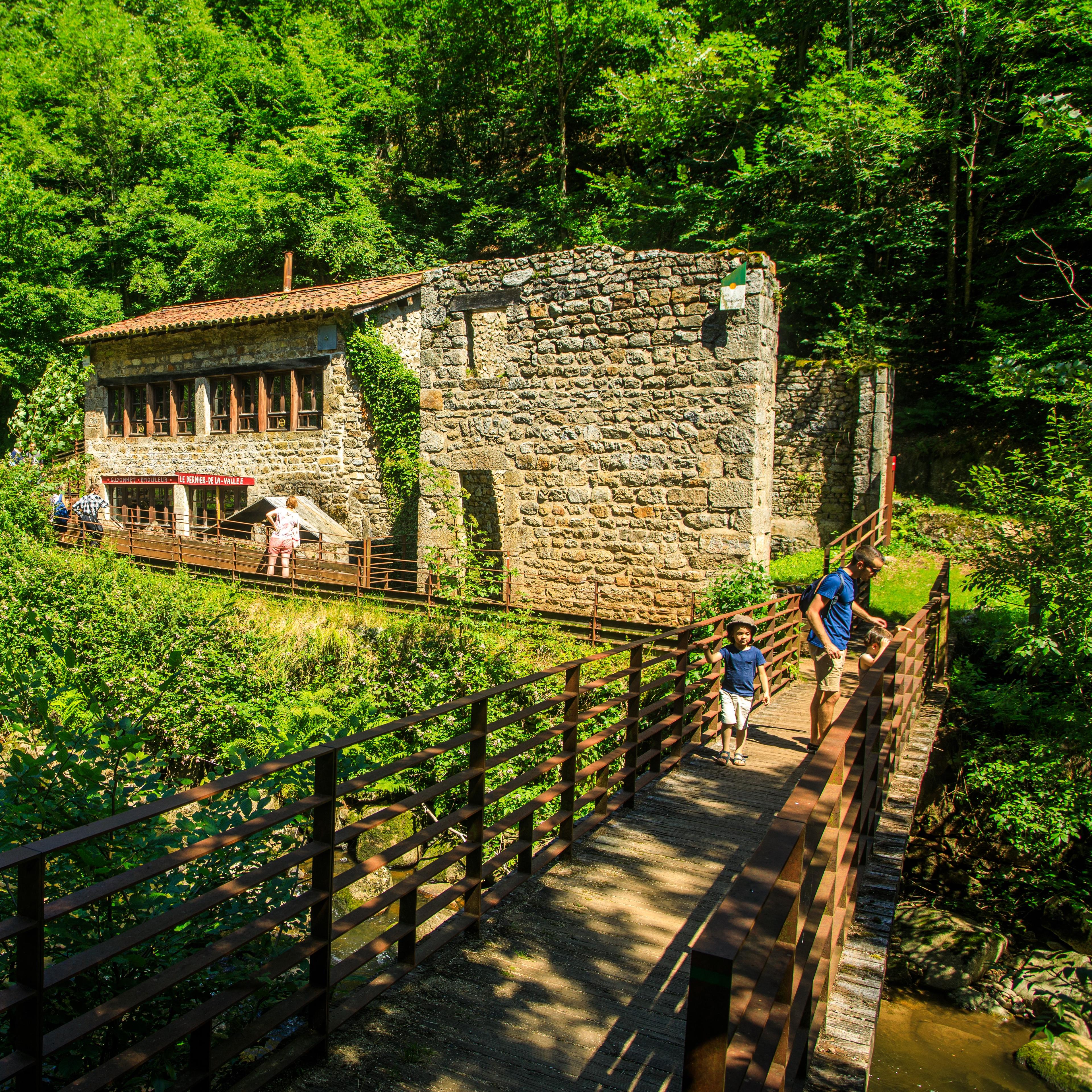
(5) At the promontory, turn right to go down towards rouets 1 to 10 then turn left straight away. Take the footbridge to get close to rouet 1 (chez Lyonnet); then go behind it, following the ramp. Then follow the path that rises on the left. Pass under the railway viaduct; a few metres further on, at the fork, just before the steps, keep climbing on the right. Cross the railway line (remember to close both gates behind you) and follow the path that rises opposite (it makes a big bend to the right then to the left) as far as Membrun.
(6) Cross the hamlet, passing through the middle of the factory. At the junction, take the D102 to the right for a few metres then turn right straight away onto the small road to Pigerolles.
(7) 300 m before the hamlet, turn left onto a path. At the junction with a wider path, turn left and always stay on the main path. The path becomes tarmac; carry on climbing straight ahead on this small road.
(8) Stay on this small road to go down towards Thiers. (viewpoint: Thiers below, Chaîne des Puys and Massif du Sancy). At the junction with another road, go straight across onto a small path. At the junction, keep going down on the left and rejoin the road.
(9) Then follow it to the right. Enter Pont-Bas then, at the junction, follow the road on the right alongside the pétanque court as far as Dégoulat (point 3). Then turn left and go down the steps to the Saint-Roch chapel. Turn left to cross the rue Saint-Roch and go down the little rue Saint-Roch opposite to the Pont de Seychalles, which you take to go back up the rue Durolle, then, at the place du Corps de Garde (pretty cross on the left) take the rue des Murailles on the left (many small workshops on the right, "hanging" gardens with vine trellises, wrought-iron railings and little kiosks, the hospital gardens, factories below, allotment gardens on the left bank). At the Porte de Saint-Jean, turn right to go alongside the cemetery and take the rue Anna Chabrol (viewpoint: ruined factory in the foreground, contemporary factory in the background, Chaîne des Puys, Massif du Sancy and part of the Cantal, old house on the right, pedde: passage under the houses). At the end of the street, go down to the left by the rue des Rochers, then at the fork take the steps on the right and take the first bridge on the left to return to the starting point (slight detour, out and back: to the right, follow "atelier de coutellerie - CRT" (cutlery workshop) and the red arrow to see an old paper mill on the right and a handle factory on the left).
In pictures

Other hikes in the area
 On foot
 On foot
 On foot