
Our take
A former railway line turned greenway, on tarmac and with a gentle slope, with its viaducts: at Dunières, you ride on the Via Fluvia, the cycle route between the Loire and the Rhône.
The Via Fluvia runs through Dunières on a former railway line: tarmac, a gentle slope and picnic areas.
The Via Fluvia runs through Dunières (43) on a former railway line, between Montfaucon-en-Velay and Riotord. From Raucoules to Riotord, the section is 19 km long, all on tarmac, with picnic areas, benches and toilets along the route.
It is not completely flat, but the slope stays under 3%: the section has 304 m of cumulative ascent, and Riotord (914 m) is higher than Dunières (790 m). In Dunières, you set off from the La Galoche car park.
No bike? Dunières has an electric bike hire business, and the Voie Verte chalet in Riotord hires hybrid bikes, electric bikes, roller skates and scooters. You are on the Via Fluvia, the cycle route that links the Loire to the Rhône.
Why we love it
- A slope of under 3%, on tarmac from Raucoules to Riotord
- The viaducts and the steam train, following the trail of the old railway line
- Picnic areas, benches and toilets spaced out along the route
- Electric bikes to hire in Dunières, and hybrid bikes, roller skates or scooters at the Voie Verte chalet in Riotord
Top tip
Set off from Dunières (790 m) towards Riotord (914 m): the outward leg climbs gently, the return is mostly downhill. At the Voie Verte chalet in Riotord, you can hire hybrid bikes, electric bikes, roller skates or scooters.
Before you go
- Dogs allowed, kept on a lead. Horse riders are not allowed on the route.
- Tarmac route with a slope of under 3%, accessible by wheelchair with assistance. The Raucoules to Riotord section still has 304 m of cumulative ascent.
- Park at the La Galoche car park in Dunières, which is one of the greenway's starting points.
- From Raucoules to Riotord, the route is tarmac along its whole length, with no dirt sections.
- For a few hundred metres, the route runs alongside a small factory where cars and lorries move around: take extra care here.
Weather for the next 3 days
Today
14°/5°
0 mm · 23 km/h
Tomorrow
14°/2°
dry · 9 km/h
Tue 27
20°/6°
0 mm · 9 km/h
Source: Open-Meteo (CC BY 4.0). General lowland forecasts, to be cross-checked with specialist mountain forecasts at altitude.
Practical info
- Address
- Av. de la Gare, 43220 Dunières, France
43220 Dunières - Monday9h–12h, 14h–18h
- Tuesday9h–12h, 14h–18h
- Wednesday9h–12h, 14h–18h
- Thursday9h–12h, 14h–18h
- Friday9h–12h, 14h–18h
- Saturday9h–12h, 14h–18h
- Today9h–12h
Opening hours
What visitors say
Google rating
Average of 186 reviews on Google Maps.
Community rating
No reader reviews yet: yours gets things started.
Your logbook
Around Via Fluvia greenway
Enough to build your day around this address.
Hikes nearby
Waymarked routes within 15 km, GPX track included.
 Cycling
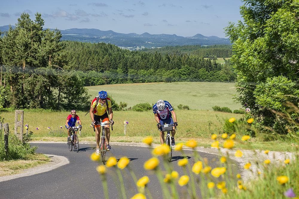
37 - On the roads of the Haut Velay
Start: Parking de la gare de Montfaucon-en-Velay
- 62.3 km
- +1174 m
- 4 h
 Mountain biking
Hikes around Via Fluvia greenway
Cycling37 - On the roads of the Haut Velay
Start: Parking de la gare de Montfaucon-en-Velay
- 62.3 km
- +1174 m
- 4 h
Mountain biking Mountain biking
You might also like
More cycling and mountain biking in Haute-Loire and nearby.

Garabit Viaduct
4.7Ruynes-en-Margeride · Cantal
1795 reviews

Gorges d'Avèze
3.0Messeix · Puy-de-Dôme
11 reviews

Cascade du Luc
3.9Mandailles-Saint-Julien · Cantal
43 reviews

Cascade du Creux de l'Oulette
4.2Saillant · Puy-de-Dôme
258 reviews

Cascade du Pont d'Aptier
4.6Collandres · Cantal
27 reviews

Vélorail du Cézallier
4.6Landeyrat · Cantal
430 reviews
Continue
Do you run Via Fluvia greenway?
Claim your page to update the details, add your photos and access our editorial feature offers.
- Free for info & photos
- Editorial feature (quote on request)
- Social media sponsorship (40 000+ Instagram and Facebook followers)