
A sea of clouds is the Limagne disappearing under a white blanket while you soak up the sun at 1,500 metres. The phenomenon has a name, temperature inversion, a season, October to February, and some good news: it can be forecast fairly well the evening before. We explain the mechanism in two minutes, then our method (the evening forecast, the morning webcams), then our five spots: the puy de Dôme, the puy de Sancy, the Banne d'Ordanche, the Col de Guéry and Puy Mary.
The phenomenon in two minutes
Normally, the higher you go, the colder it gets. A temperature inversion is exactly the opposite: cold air at the bottom, mild air at the top.
The typical scenario plays out under an autumn or winter anticyclone. Nights are long and clear, the ground loses its heat, and the cooled air, denser, slides down the slopes to pool in the plains and valleys. If it's humid enough, it condenses: that's fog, a cloud sitting on the ground.
Above, the air stays milder and acts as a lid. Nothing mixes. Below, grey gloom, frost, sometimes zero degrees all day. Above the layer, bright sun, dry air, and often several degrees warmer than in town.
The Limagne is made for it: a low, humid, enclosed plain. Seen from Clermont-Ferrand, it's a depressing foggy day. Seen from the summit of the puy de Dôme, 1,000 metres higher, it's a white ocean from which the puys emerge, like an archipelago.
When to see it: the season and the right time slot
The inversion season runs from October to February. The heart of the season is November and December: settled anticyclones, ground waterlogged after the autumn rains, long nights. It's also the period when the layer can last all day. In October and February, it breaks up more readily late in the morning.
| Month | Our forecast | What to know |
|---|---|---|
| October | Good | First inversions after the rains, Puy Mary is still accessible |
| November | Very good | The heart of the season, thick, lasting layers |
| December | Very good | Late sunrise (around 8:30), the layer often lasts the day |
| January | Good | Hard cold on the plain, frost, summits sometimes in a full thaw |
| February | Fair | Windows between weather systems, snow at altitude |
The prime slot is daybreak. Depending on the date, the sun rises between about 7:15 (late October, just after the clocks go back) and 8:30 (late December, early January). December is the month for late risers: you can see the dawn without getting up at 5 o'clock.
In midwinter, there's no need to stress about it: a well-established inversion offers its sea of clouds until mid-afternoon. It's one of the pleasures of Auvergne in autumn and of the whole late season: one person's bad weather makes another's finest days.
Forecasting it the evening before: our method
A sea of clouds can't be improvised, you have to watch for it. Here is the routine to follow the evening before, in two steps.
The four evening signals
- A settled anticyclone. High, stable pressure for a day or two, no weather system forecast. This is the basic condition.
- A clear night forecast. Clear sky at night: the ground radiates heat, the air below cools quickly.
- Light wind on the plain. Too much wind stirs the air and stops the layer forming.
- Moisture in the low layer. A mild day, ground wet from recent rain, dew in the evening: the water vapour is there, ready to condense.
Four boxes ticked: you're in with a real chance. A shortcut we like: compare the temperatures forecast for early morning on the plain and at around 1,500 metres on a mountain forecast. If it's forecast milder at altitude than in Clermont-Ferrand, the inversion is already in the models.
The morning decider: the webcams
This is THE reflex to adopt before setting off. Public live webcams tell you in ten seconds whether the summit is in the sun:
- On the Sancy side, the resorts stream their webcams live: Le Mont-Dore (resort summit, with a direct view of the puy de Sancy), Super-Besse, Chastreix-Sancy, and even Lac Chambon lower down.
- On the puy de Dôme side, the Panoramique des Dômes brings together the live summit weather and its webcams on a single page. Two other public views exist, one taken at the summit and another of the puy de Dôme from the Cézeaux campus, refreshed every ten minutes.
The rule is simple: if it's grey where you are and bright blue on the altitude webcam, get dressed, it's the right morning. If the summit webcam is in cotton wool, the layer tops out too high: stay in bed or aim for a higher summit.
One last word: the phenomenon is never guaranteed. A layer too high, a dissipation too fast, and you climb for nothing. It's part of the game, and the walk is still lovely.
Where to see it: our five spots
| Spot | Altitude | Climb for dawn | The extra |
|---|---|---|---|
| Puy de Dôme | 1,465 m | 45 min to 1 hr on foot | The whole Limagne at your feet |
| Puy de Sancy | 1,885 m | About 2 hrs on foot, until 31 October | 360° view, layers on both sides |
| Banne d'Ordanche | 1,512 m | 2 hrs there and back | The Sancy massif opposite |
| Col de Guéry | 1,268 m | None: you park | The Tuilière and Sanadoire rocks |
| Puy Mary | 1,783 m | About 30 min (October) | The Cantal as an archipelago |
The puy de Dôme: the classic above the Limagne
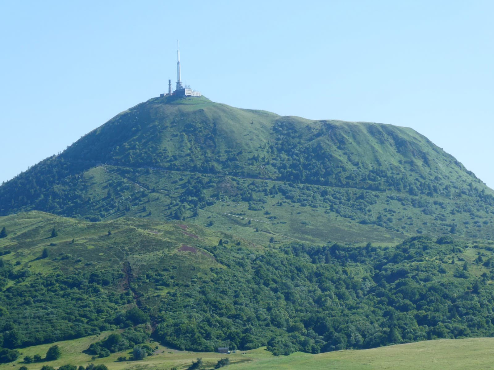
The puy de Dôme (1,465 m) directly overlooks the plain where the layer forms: it's the ideal balcony for a first try. When the inversion is there, the whole floor is white and the Chaîne des Puys emerges in a line.
For daybreak, you go on foot. The shorter of the two paths is the Muletiers path, from the Col de Ceyssat: 1.9 km, 350 m of climbing, 45 minutes to 1 hour of walking on a path waymarked in yellow. Set off 1 hour 30 before sunrise, head torch on. The other, the Chèvres path, starts from the Maison de site (the visitor centre), at the train's departure station, and takes 1 hour 30 to 2 hours of walking for 6 km.
Worth pinning down before you block out your morning: from Monday 5 October to Friday 16 October, including the weekend of 10 and 11, the Muletiers path is closed for works and the Col de Ceyssat car park is inaccessible. Over those two weeks, the climb on foot is by the Chèvres path, from the Panoramique des Dômes car park.
The Panoramique des Dômes train never leaves early enough for dawn, and its timetable tightens at the start of winter. For the 2026-2027 season: a train every 40 minutes from 9:00 to 19:00 until 1 November; from 2 November to 18 December, one train an hour from 10:00 to 17:00, closed on Mondays and Tuesdays, with a maintenance week from 16 to 20 November; from 19 December to 3 January, a train every 30 minutes from 10:00 to 17:00, closed on 25 December. Allow between €17.20 and €18.60 for an adult return depending on the period. On the other hand, it's perfect for a layer that lingers in the morning, which often happens in November and December. All the access details are in our guide climbing the puy de Dôme.
The puy de Sancy: the roof of the Massif Central
2026-2027 season: the Sancy cable car is closed for works from 31 August to 18 December 2026. For that whole period, the summit of the puy de Sancy (1,885 m, the highest in the Massif Central) can only be reached on foot.
The classic route starts from the Le Mont-Dore resort car park and goes up the val de Courre: 560 m of climbing, allow 2 hours for the climb at an easy pace. For dawn, that means setting off 2 hours 30 before sunrise, in the dark, on a waymarked path. One caveat, and it matters: the waymarked route to the summit is listed as open from 1 May to 31 October, and it closes as soon as the ski area opens; in winter, the stairs leading to the summit and the ridge paths are closed too. The Sancy is therefore an October spot; for the heart of the season, aim for another summit. It's demanding, and it's the finest reward on the list: at 1,885 m, you look down on everything, with sometimes a layer on the Limagne side to the east and another in the valleys to the west. Our guide climbing the puy de Sancy details the route.
The cable car reopens on 19 December 2026, with departures from 9:00 to 17:15: after sunrise, but not necessarily after the sea of clouds, which readily lingers on winter mornings. Be careful, in winter the cabin doesn't take you to the summit: it drops you at 1,790 m, and the stairs up to the highest point are closed. You take in the view from the top station.
La Banne d'Ordanche: the Sancy opposite
A spot we recommend without hesitation: the Banne d'Ordanche (1,512 m), a volcanic peak above Murat-le-Quaire. The effort-to-reward ratio is excellent: from the car park at the end of the little road that climbs from the village, 6 km higher up, the yellow waymarking goes via the col du Saint Laurent and leads to the summit in 2 hours there and back, with a finish up a wooden staircase that comes out at the orientation table in enamelled lava.
Facing you, the whole Sancy massif catches the morning light. Below, the layer fills the upper Dordogne valley and drowns Le Mont-Dore and La Bourboule. Aim for a November morning: climb with a head torch, a flask in the bag, and watch for daybreak above the layer. It's this kind of morning that makes you love the season. Walkers can also make it the goal of a 3-hour loop, of moderate difficulty, from the chalet de la Banne, 2 km above the village. And before aiming for midwinter, be aware that the road up to the car park closes from December to the end of March, depending on snow cover.
Col and Lac de Guéry: a sea of clouds without walking
The Col de Guéry (1,268 m), on the road between Orcival and Le Mont-Dore, is the spot for those who don't want to (or can't) walk: you park, cross the road, and the viewpoint overlooks the Fontsalade valley, framed by the Tuilière and Sanadoire rocks.
When the layer is low, it literally pours between the two rocks: it's one of the most photographed images in Auvergne, and it's earned above all by punctuality. A step away, Lac de Guéry (1,244 m, the highest lake in Auvergne) adds the early-morning frost to the picture.
The flip side of the modest altitude: if the layer tops out higher than the col, you'll be inside it, in thick fog. This is the spot where a glance at the webcams before setting off changes everything.
Puy Mary: the Cantal version, to enjoy in October
On the Cantal side, Puy Mary (1,783 m) offers a different sea of clouds: here, not a single plain, but glacial valleys radiating out like a star around the summit. When they fill with fog, the ridges draw an archipelago of green and brown blades.
From the Pas de Peyrol (1,588 m), the highest road pass in the Massif Central, allow a short half-hour for the climb up the path laid out with steps. Mind the window of opportunity: the roads to the Pas de Peyrol close with the first snows, generally from early November until spring (late April to mid-May depending on snow cover). For a sea of clouds at Puy Mary by car, it's therefore October or nothing. Dress warmly, the wind on the ridge is unforgiving.
A final mention for the pic de Brionnet, above Saurier: a small summit topped with a chapel, well known to local photographers, which emerges nicely from the layers in the Couze Pavin valley. Discreet, quickly climbed, often deserted.
Photographing a sea of clouds
The subject is photogenic, but it has its traps. Our tips, valid from DSLR to smartphone:
- Arrive 30 to 45 minutes before sunrise. The blue hour above a layer is often more beautiful than the sunrise itself. And the golden light that follows skims the surface of the clouds and gives it depth.
- Expose for the highlights. A backlit sea of clouds burns out fast: underexpose slightly, and lift the shadows afterwards.
- On a smartphone, lock the exposure on the sky and switch on HDR mode. A mini tripod helps a lot in the blue hour.
- Think about a telephoto lens (or the phone's x3 zoom) to isolate a puy that emerges: “islands in the ocean” images are often stronger than the wide angle.
- Stay after sunrise. When the layer starts to undulate and fray over the ridges, there are pictures to take every five minutes.
To find other viewpoints that work well at dawn, dip into our photo spots in Auvergne.
Safety and equipment: you set off in the dark, you don't improvise
A sunrise at altitude means a night-time start in sub-zero temperatures. Nothing technical on the routes mentioned outside winter conditions, but the waymarked Sancy route is classed as difficult, and at night the margin for error is thin. A few rules to follow:
- A charged head torch (plus a spare one or batteries), even for “only” 30 minutes of climbing.
- Waymarked paths only, never off-path. At night, in an area of rock bands like the Sancy, it's non-negotiable. And if the layer rises and wraps around you, don't count on the waymarking to guide you: in bad weather and in fog, these routes are not recommended. IGN map, track on the phone, and you turn back without argument.
- Dress for winter from October. Three layers, hat, gloves, and a down jacket for the wait at the summit: you get cold very fast when you stop. The flask of coffee is not a gimmick, it's equipment.
- Watch your feet. Frozen ground, frosted boards, the first patches of snow: high-cut walking boots, and chain-style micro-spikes in the bag from the first frosts. As soon as there is settled snow or ice, don't settle for micro-spikes: in winter conditions, these mountain routes are not always passable, and some are even prohibited. Without equipment or experience of snow, aim for a spot with no climb.
- Tell someone your route and your timing, and keep an eye on the phone battery: the cold drains it at top speed.
If you take a liking to early starts, our guide to autumn hikes in Auvergne will give you more ideas for the same season.
Frequently asked questions
The FAQ
What is the best time to see a sea of clouds in Auvergne?
From October to February, with a peak in November and December: lasting anticyclones, damp ground, long nights. In midwinter, the layer can persist all day above the Limagne. In October and February, it more often dissipates late in the morning, so aim for daybreak.
What time do you need to be at the summit?
Ideally 30 to 45 minutes before sunrise, which happens between about 7:15 (late October) and 8:30 (late December) depending on the date. Add your climbing time: 1 hour 30 before sunrise for the puy de Dôme from the Col de Ceyssat, 2 hours 30 before for the Sancy. From 5 to 16 October, the Col de Ceyssat car park is inaccessible: the climb up the puy de Dôme is then by the Chèvres path, from the Panoramique des Dômes car park, which means 1 hour 30 to 2 hours of walking.
Can you see a sea of clouds without hiking?
Yes. The Col de Guéry (1,268 m) can be reached by car: the viewpoint over the Tuilière and Sanadoire rocks is a few steps from the car park. Another effortless option: the puy de Dôme train in the morning, when an inversion layer persists, with a first departure between 9:00 and 10:00 depending on the period.
Is the Sancy cable car running in autumn 2026?
No. It is closed for maintenance works from 31 August to 18 December 2026, and reopens on 19 December 2026, from 9:00 to 17:15. Until 31 October, the summit of the puy de Sancy is reached on foot from the Le Mont-Dore resort, for example via the val de Courre (about 2 hours of climbing); after that date, the waymarked route closes as soon as the ski area opens, and in winter the summit stairs and the ridge paths are both closed.
How can you tell the evening before whether there will be a sea of clouds?
Check four signals in the evening forecast: settled anticyclone, clear night, light wind, humidity on the plain. If the forecasts predict an early morning milder at 1,500 m than on the plain, the inversion is likely. Confirm on waking with the Sancy and puy de Dôme webcams before getting in the car.
Is a smartphone enough to photograph a sea of clouds?
Yes, easily. Switch on HDR, lock the exposure on the sky to avoid burning out the clouds, and steady the phone on a rock or a mini tripod in the blue hour. The telephoto zoom neatly isolates the summits that emerge. The truly essential kit is gloves and a head torch.