
The Velay greenway, known as the Via Velay, follows the old railway line from Le Puy-en-Velay to Langogne, which opened in 1912 and closed to traffic in 1988. The result today: 35 km of track at an average gradient of 2% between Brives-Charensac, on the edge of Le Puy, and Landos, with five tunnels, a metal viaduct and the Loire valley as a backdrop. It's the easiest bike outing in the area: no traffic, no nasty surprises on the climbs, and scenery that changes every fifteen minutes.
One clarification up front, because everyone mixes them up: the Via Velay is neither the Via Fluvia nor the Transcévenole. We untangle the three a little further down.
The Via Velay at a glance
- Start: Brives-Charensac, at the end of the avenue de la Gare (the centre of Le Puy-en-Velay is 4 km away)
- Finish: Landos, on the plateau, at about 1,100 m
- Distance: 35 km
- Gradient: 2% on average, steady (it's a railway bed)
- Surface: well-compacted fine gravel from Brives-Charensac to Solignac-sur-Loire, much sandier and more uneven above that; about 1 km of tarmac between Costaros and Landos
- Who it's for: on foot, by hybrid bike or mountain bike; road bikes are not recommended. Pushchairs and wheelchairs only on the Brives-Charensac / Solignac-sur-Loire section, the only one with a properly smooth surface. Above Solignac, the grey sand sinks under the wheels and rules out wheelchairs
- What to bring: a torch and a jacket for the tunnels, which are cool all year round
The route, section by section
From Brives-Charensac to Coubon: the Loire valley
You set off from the site of the old Brives-Charensac station. The track first runs alongside the Loire, with the Château de Bouzols keeping watch above the valley. An easy, shaded section, ideal for warming up your legs.
From Coubon to Solignac-sur-Loire: tunnels and viaduct
The showpiece. All five tunnels come one after another here, over a handful of kilometres: Taulhac (1.1 km), the Riou (1,268 m, the longest), then the Malpas, the Pradeaux and the Veneyres, which are shorter. In 2022, the Le Puy agglomeration began renovating their lighting: 272 LED floodlights in place of the old fluorescent tubes. The tunnels are lit until nightfall: for a late outing, bring your torch. Keep a jacket with you all the same, as it's cool and damp in there even in the height of August. Coming out of the Veneyres, you emerge onto the Gagne viaduct, 184 m of metal spans above the valley, with a completely rebuilt deck. Solignac-sur-Loire is just beyond.
From Solignac-sur-Loire to Costaros: the plateau
The line climbs gently from 850 to nearly 1,100 m, still at an average of 2%. Not a single tunnel here, they're all behind you: the landscape suddenly opens onto the Devès plateau, with the Mézenc massif on the horizon. Watch the surface, though: this is the most thankless stretch of the route, with grey sand and coarse gravel in places. As you arrive at Costaros, the Péchay maar, a reservoir in an old explosion crater, makes a good stop before tackling the last section towards Landos.
From Costaros to Landos: the newest section
The last section of the old line to be developed, this segment starts with about 1 km of tarmac before going back to compacted sand. At both ends, there are reception areas: shelters, picnic areas, water points and panels telling the story of the line. Beyond Landos, the old line carries on towards Langogne, and it's the Pradelles rail bike that operates part of it, from Pradelles station: the greenway really does stop at Landos.
Which way should you ride it?
From Brives-Charensac to Landos, it's uphill all the way: 600 m above sea level at the start, 1,100 m at the finish. At 2% it's rideable, but over 30 km you feel it in your legs. For a really easy family outing, do it the other way round: leave the car at Solignac-sur-Loire or Costaros and let the slope take you down towards the Loire.
Practical information
Car parks. Three car parks on the historic section: at Brives-Charensac (at the end of the avenue de la Gare), at the old Coubon station and at Solignac-sur-Loire. On top of these, there are the reception areas at Costaros and Landos.
Bike hire. CycleXperience, based in Brives-Charensac itself (137 avenue Charles Dupuy), hires out electric hybrid bikes and electric mountain bikes a few steps from the start. In Le Puy, the agglomeration's Vélo-en-Velay service hires out electric-assist bikes by the week or the month, but it is reserved for residents of the 72 communes of the Agglo.
Without a car. Le Puy-en-Velay train station is about 4 km from the starting point.
Season. Access is subject to favourable weather: at the top, the route climbs to 1,120 m. The tunnels, meanwhile, stay cool and damp all year round.
Map and route. The official Via Velay website publishes the leaflet and the detailed route of the trail.
Via Velay, Via Fluvia, Transcévenole: stop mixing them up
Three old railway lines in the Velay, three different routes:
- The Via Velay, the one in this guide: from Brives-Charensac to Landos, 35 km on the old Le Puy to Langogne line.
- The Via Fluvia: from Lavoûte-sur-Loire towards Annonay, between the Loire and the Rhône. On the Haute-Loire side, 62 km are developed from Lavoûte-sur-Loire to Riotord; then other sections in the Loire and Ardèche départements, linked by undeveloped connections, including a crossing of the centre of Annonay. In the end, the route will cover more than 120 km. It's the one that goes through Yssingeaux and Raucoules: if someone has talked to you about "the greenway" on the Yssingeaux side, this is the one.
- The Transcévenole: from Le Puy towards Présailles via Le Monastier-sur-Gazeille, on a line that was never completed. A walking path, not a surfaced greenway. The Recoumène viaduct and its bungee jump belong to this one.
Around the greenway
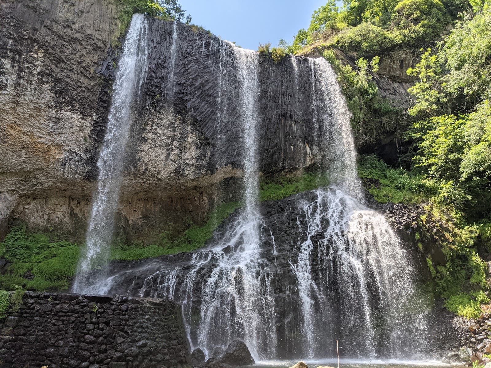
2 km from the greenway, along the PR67 trail that branches off from it at km 17.6 on the Solignac-sur-Loire side, the Beaume waterfall is worth the detour, especially after rain. From the Reynardon car park, allow 40 minutes on foot there and back. On the plateau side, Lac du Bouchet is 6 km from the greenway. And to plan the rest of your stay: the Le Puy-en-Velay page and our hikes in Haute-Loire.
Good to know before you go
Can you ride it on a road bike? Not recommended. From Brives-Charensac to Solignac-sur-Loire it's well-compacted fine gravel: excellent on a hybrid or mountain bike, easy going with a pushchair or wheelchair, but tricky on thin tyres. Above Solignac, grey sand and coarse gravel take over again: no wheelchairs, no narrow wheels. The Costaros-Landos section has about 1 km of tarmac, and the rest is sand.
Are the Via Velay and the Via Fluvia the same thing? No. The Via Fluvia links the Loire to the Rhône via Yssingeaux; the Via Velay heads down from Le Puy towards Landos. Two different old railway lines that don't cross.